The State Government’s release of the Sydney Metro City and Southwest Project Update has flagged some key changes with interesting implications both for transport and urban planning in Sydney, though it hasn’t resolved the key issue of which alignment and station option will be selected for the stretch between Central and Sydenham Stations.
The Update confirms that the line will extend the Sydney Metro Northwest currently under construction from its terminus at Chatswood through the city to Sydenham, from where it will run on a converted Bankstown line to Bankstown and possibly beyond. The line is due to open in 2024. The government has also released the project’s Early Community Consultation Submissions Report which details major issues raised in the first round of submissions on the project as well as the government’s response to these. Key features of the revised project include:
Project scope and tunnelling
- The original proposal had explored the option for the line to run on the surface within the existing corridor at least part of the way between Chatswood and St Leonards stations heading underneath just near the latter, or alternatively running underground all the way from just south of Chatswood. The project update has indicated that based on consultation feedback the second option has been chosen and that therefore the line will run entirely underground for 16 km from just south of Chatswood to Sydenham.
- The project is now divided into two components. The first is involves twin 15 kilometre tunnels from Chatswood to Sydenham via the CBD and the second the upgrade and conversion of the existing 13.5 kilometre line from Sydenham to Bankstown to be integrated with the metro.
- Combined with the 15km of tunnel currently being bored from Epping to Bella Vista for Metro Northwest and the underground 13km Epping to Chatswood rail link also being converted for Metro Northwest, this means that the completed metro will contain 44km almost entirely in tunnels, apart from a brief section of surface running at Chatswood and open-cut stations at Bella Vista and Cherrybrook.
- Comment: This is around two-thirds of the Sydney Metro’s total length from Cudgegong Road to Bankstown (65km); if the Chatswood Station section of the proposed line were also underground (and discounting the open cut stations), this would have made the Sydney Metro the fourth-longest fully underground metro line in the world, after Line 3 of the Guangzhou Metro (60.4km – longest branch), Line 10 of the Beijing Subway (57.1km) and Line 5 of the Seoul Subway (47.6km – longest branch). As it stands, the underground section of the line will be separated at Chatswood into 28km (to Bella Vista) and 16km (to Sydenham) sections.

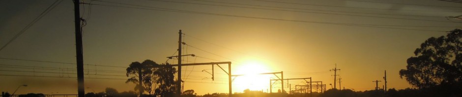
Sydney Metro Proposed Alignment (from Transport for NSW, 2015. Sydney Metro City and Southwest Project Update)
Station locations – North Shore
- Partly as a result of this and feedback from the consultation process, the station proposed for the Artarmon Industrial Area has been eliminated and the option of a new station at Crows Nest has been selected over an interchange at St Leonards station with the North Shore Line. Crows Nest station will be located on the western fringe of the Crows Nest village with entrances from the corner of Hume and Clarke Street and the corner of the Pacific Highway and Oxley Street. It will be approximately 600 metres from the existing St Leonards Station and will service this larger precinct as well as Crows Nest itself.
- The location of Victoria Cross station at North Sydney has been confirmed in the northern section of the North Sydney CBD, with access via the eastern side of Miller Street between Berry Street and Mount Street. The station will be only 450m from the North Sydney Station and will both help relieve demand at the existing station and support the growth of the North Sydney CBD.
- Comment: The Artarmon option had been explored as a basis for new development, so the decision to drop it means that additional development in the lower North Shore associated with the metro will be largely confined to the established areas around Chatswood, Crows Nest and North Sydney. It also means there will be only two metro stations (Crows Nest and Victoria Cross) between Chatswood and the CBD. This compares with the six stations on the existing North Shore Line. In addition there will be no interchanges with the North Shore Line between Chatswood and the city. The implications of the interchange arrangements with the existing rail network are discussed below.
Station locations – CBD
- The location of Barangaroo Station has been confirmed. It will be the first station in the CBD, located beneath the northern end of Hickson Road in Millers Point between the new Barangaroo Reserve and the Central Barangaroo development about 700m from Wynyard Station. As well as servicing these it will improve access to the Walsh Bay arts precinct and the northern part of the CBD, relieving congestion at Wynyard Station.
- Martin Place station will be located south of Hunter Street between Castlereagh and Elizabeth Streets and will be integrated with the existing Martin Place station to provide an interchange with the Eastern Suburbs and Illawarra Lines. It will service Sydney’s financial district, the Macquarie Street civic precinct and the Pitt Street retail zone. As well as helping to relieve Wynyard and Town Hall Stations it will provide a new cross-CBD connection to Barangaroo.
- Pitt Street Station will be below Pitt and Castlereagh Streets, running from north of Park Street to south of the Bathurst Street, with entrances on the north side of Park Street, the south side of Bathurst Street and on the north-eastern corner of Pitt and Park Streets. It will be only about 150m from Town Hall Station, effectively just across the road from it, but will not have a direct connection to avoid overcrowding at Town Hall. The station will service the southern CBD, midtown retail precinct and Chinatown and provide an interchange with the CBD and South East Light Rail currently under construction, as well as with bus services.
- The station at Central will be within the existing Central Station precinct below intercity rail service platforms 13, 14 and 15 and provide integration with the existing suburban, intercity and country rail lines and bus services, as well as both the current light rail line and the one under construction. The project update indicates that entry will be via the existing main northern concourse at Central Station only and makes no mention of an entry or an interchange at the southern end.
- Comments: The metro will parallel the North Shore Line as it runs north-south through the CBD, though it switches from the western to the eastern side of the CBD as it does so. Of the four CBD stations two are interchanges (Martin Place and Central) and one (Pitt Street) is with 150m of an existing station (Town Hall). While this approach will relieve capacity on the existing network it will provide only one station with a substantially new catchment and destination in the CBD at Barangaroo.
- The arrangements at Central are intriguing. It is unclear if it is for technical reasons (for example, the depth of the tunnels) or practical ones that the location under Intercity platforms 13 to 15 was selected over the existing disused tunnels above the Eastern Suburbs/Illawarra platforms, but the choice of the latter on the eastern side of the station would have clearly favoured the Waterloo option over the University of Sydney as the choice for the next stop on the line (see below). The preferred location announced in the Update which is just to the west of the suburban platforms does not appear to favour one option over the other and also provides reasonable access to the Intercity platforms as well as the suburban rail network.
Station options: University of Sydney or Waterloo
- The Project Update indicates that a choice is yet to be made regarding whether the only station to be provided between Central and Sydenham will be located at the University of Sydney or at Waterloo. The former would service the large university population as well as the RPA health precinct, Glebe Point Road and the Broadway shopping area, while the latter would support the revitalisation and development of the Waterloo precinct and Australian Technology Park as well as the expansion of the Global Economic Corridor between the CBD and Green Square.
- The University has proposed a $1.5 billion “knowledge hub” with retail, offices and research facilities to be integrated with the new station. Its preferred site is in Maze Crescent (parallel to City Road). Meanwhile UrbanGrowth NSW has claimed that the Waterloo option would support the replacement of 2,000 public housing units and the broader redevelopment of the area which is just south of the CBD
- Comments: The Submissions Report noted that the majority of submissions favoured the University option for the reasons outlined above and also because of the large potential demand from students. This would support patronage of the line throughout the day and in doing so alleviate the current pressure on local bus services. The report commented briefly on the proposal put forward in a “small number of submissions” for stations in both locations (which was one of the options I proposed in my response), stating that this wasn’t feasible as the they are on “separate alignments” though it did not explain this further. It also noted that some of the submissions opposing the Waterloo option suggested that a more cost-effective alternative would to add a station to the current Airport Line but did not offer a view on the feasibility of this.
- The Minister has indicated to the media that the choice is “a difficult decision” but hoped that it would be made by the end of the year. It will be interesting to see whether the strong case put up by the University which is based on servicing the existing strong demand in this location will win out over the advice to the government from its own agency supporting the Waterloo option as a basis for new residential development.
Erskineville, St Peters and the Sydenham to Bankstown corridor
- The Project Update has confirmed the initial proposal to upgrade the existing Sydenham to Bankstown line and integrate it with the metro. The Submissions Report noted that a number of other lines were considered but the Bankstown line was favoured because removing this line from the existing network would provide a significant boost to rail capacity in the CBD, allowing an increase from 120 to 200 trains entering the city in peak hour. This would allow the wider network to accommodate an extra 100,000 passengers in the peak. In addition the Department of Planning and Environment will support “place-based renewal” at stations in this corridor.
- The Project Update also discussed Erskineville and St Peters stations which are currently served only by Bankstown line trains but which will be bypassed by the metro which will be entirely underground from Central to Sydenham. The report indicates that they will continue to be serviced by trains on the existing network.
- Comments: Along with the commitment to single-deck trains, the decision to link the metro to the Bankstown Line is one of the fundamental differences to the previous Metropolitan Rail Expansion Program (MREP). This had proposed linking the then proposed North West Rail Link to the East Hills Line to Campbelltown to provide a high-capacity limited-stop service linking the major growth centres in the southwest and northwest to the CBD, similar to the double-deck RER services in Paris or the Regionalbahn services in Berlin and other German cities.
- As Jacob Saulwick noted in an opinion piece earlier this year however, the decision by the previous transport minister to build the metro with single-deck trains virtually ruled out this option. This is because single deck trains do not have the capacity to deal with the existing and growing demand on this line, especially as Saulwick noted that “you could not ask the majority travelling to the city from Campbelltown to stand the whole way”. It is one thing to make the majority of passengers on a brand-new service stand but quite another to force passengers on an established line who are used to seated travel to stand. The shorter and more lightly-used Bankstown Line was chosen instead.
- The confirmation that Erskineville and St Peters stations will be serviced by other lines means that the timetables for these services will have to be revamped and travel times may be longer. It also has implications for the initial premise that the metro line would divide at Sydenham with one branch going to Bankstown and the other to Hurstville. All references to Hurstville appear to have been dropped in the project plans.
Services beyond Bankstown and the proposed extension to Liverpool
- The revised plan reiterates that suburban services will continue to operate on the remaining portions of the line beyond Bankstown to Liverpool and Lidcombe via Regents Park, accessing the metro at an upgraded interchange at Bankstown. There is no detail however regarding the way this sector will operate.
- The Project Update also indicated that the Bankstown end of the line will be “safeguarded” while a possible extension to Liverpool is investigated. The Update noted that this extension “could cut travel times from Liverpool to the CBD by up to 15 minutes and reduce crowding on the existing T1 Western Line and T2 South Line” and that there would be further investigations and consultation in 2016.
- Comments: Obviously there needs to be further consideration of the options for rail services on the existing lines between Liverpool, Regents Park, Lidcombe and Bankstown. This needs to include consideration of options to convert this sector to light rail to be integrated into the proposed Western Sydney light rail system to be centred on Parramatta.
- It is unclear what corridor will be investigated for the proposed metro extension to Liverpool but appears that a more direct route than the existing link via Regents Park is being considered. A direct link would be approximately 10 kilometres long and opens up the potential for redevelopment at or near Bankstown Airport. It also raises the possibility of a further extension to a future Badgerys Creek Airport. This would be 17 kilometres long but would still be shorter than an extension of the recently-opened South West Rail Link.

Pingback: The Sydney Metro City and Southwest stations – why these locations? | StrategicMatters
Pingback: What happened in StrategicMatters in 2015? | StrategicMatters